


Ride_2021-02-28_ebike-connect

topolino
User
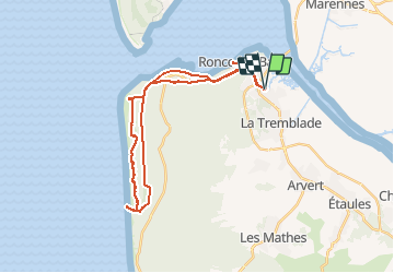

Length
33 km

Max alt
32 m

Uphill gradient
223 m
Km-Effort
36 km

Min alt
0 m

Downhill gradient
222 m
Boucle
Yes
Creation date :
2021-03-01 17:14:49.215
Updated on :
2021-03-01 17:22:33.926
--
Difficulty : Easy

FREE GPS app for hiking
 SityTrail
IGN / Geographical institutes
SityTrail Plus
The world is yours!
About
Trail Mountain bike of 33 km to be discovered at New Aquitaine, Charente-Maritime, La Tremblade. This trail is proposed by topolino.
Positioning
Country:
France
Region :
New Aquitaine
Department/Province :
Charente-Maritime
Municipality :
La Tremblade
Location:
Unknown
Start:(Dec)
Start:(UTM)
643623 ; 5071617 (30T) N.
Comments